A more than 1,200-mile corridor from Wisconsin to Texas could see severe weather beginning Friday afternoon, with more than 7 million people under the greatest risk of seeing large hail across Iowa and other parts of the Midwest and Central Plains.
Supercell thunderstorms are expected to develop during the early evening and into the overnight, and could produce “monster” hail 3 inches in diameter, as well as tornadoes.
The multiday threat began on Thursday when numerous Severe Thunderstorm Warnings were issued across the Texas and Oklahoma Panhandles, with wind gusts of 70 mph reported.
A video on social media showed cloud-to-ground lightning during severe storms in southern Kansas.
While a layer of warm air in the atmosphere has the potential to limit afternoon storms on Friday, supercell thunderstorms are expected to break through that “atmospheric cap” by the evening.
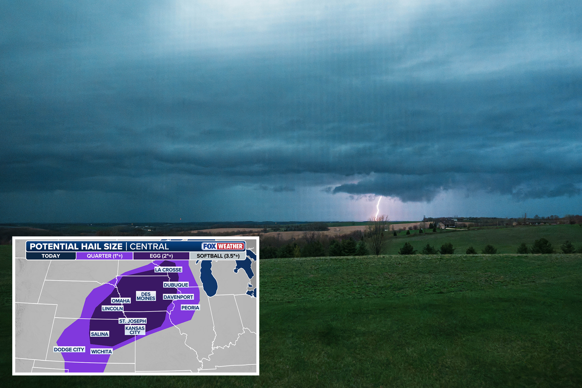
NOAA’s Storm Prediction Center (SPC) has issued a Level 3 out of 5 risk of severe thunderstorms for Central Iowa, including Des Moines, which could see 3-inch hailstones with any supercells that develop.
While tornadoes are not the main hazard on Friday, the Level 3 threat zone is where they would most likely form.
A broader Level 1 threat stretches from Wisconsin through parts of North and West Central Texas, where isolated damaging wind gusts up to 70 mph are possible.
Large hail, 2 inches in diameter, will be possible across a corridor from southern Minnesota and the Texas and Oklahoma Panhandles.
3-inch hail will remain the main threat through Saturday as severe storms reload over the Plains and parts of the Midwest.
A Level 2 threat covers much of Nebraska and western and central Iowa, with a Level 1 threat expanding into Illinois, Indiana, Ohio, and Kentucky.
A similar pattern is expected to emerge Saturday with spotty storm coverage in the afternoon and supercells expected to consolidate by the evening when the threat of tornadoes starts to increase.
Severe weather is expected to last through the weekend and into the early part of next week.
The SPC is now warning that there is an “increasing chance of strong to intense tornadoes” on Monday afternoon in central Kansas into northern Oklahoma.
FOX Weather has live coverage of severe weather through the weekend and has the latest forecast updates.