Monday, April 27, 2026
Privacy-First Edition
Back to NNN
Science

Satellite images show scale of Israeli destruction of south Lebanon towns

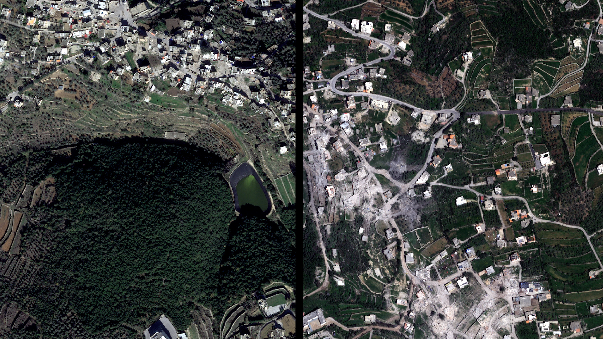
play Live Sign upShow navigation menuplay Live Click here to searchsearchSign upToggle PlaySatellite images show scale of Israeli destruction of south Lebanon towns

Satellite images taken on April 16 reveal the massive scale of damage to the towns of al-Qozah and Beit Lif in south Lebanon, following the Israeli military’s ground invasion and sustained attacks on the south.

Read original at Al Jazeera English

The Perspectives

0 verified voices · Three viewpoints · Real discourse

Left
0
Be the first to share a left perspective
Center
0
Be the first to share a center perspective
Right
0
Be the first to share a right perspective

Related Stories