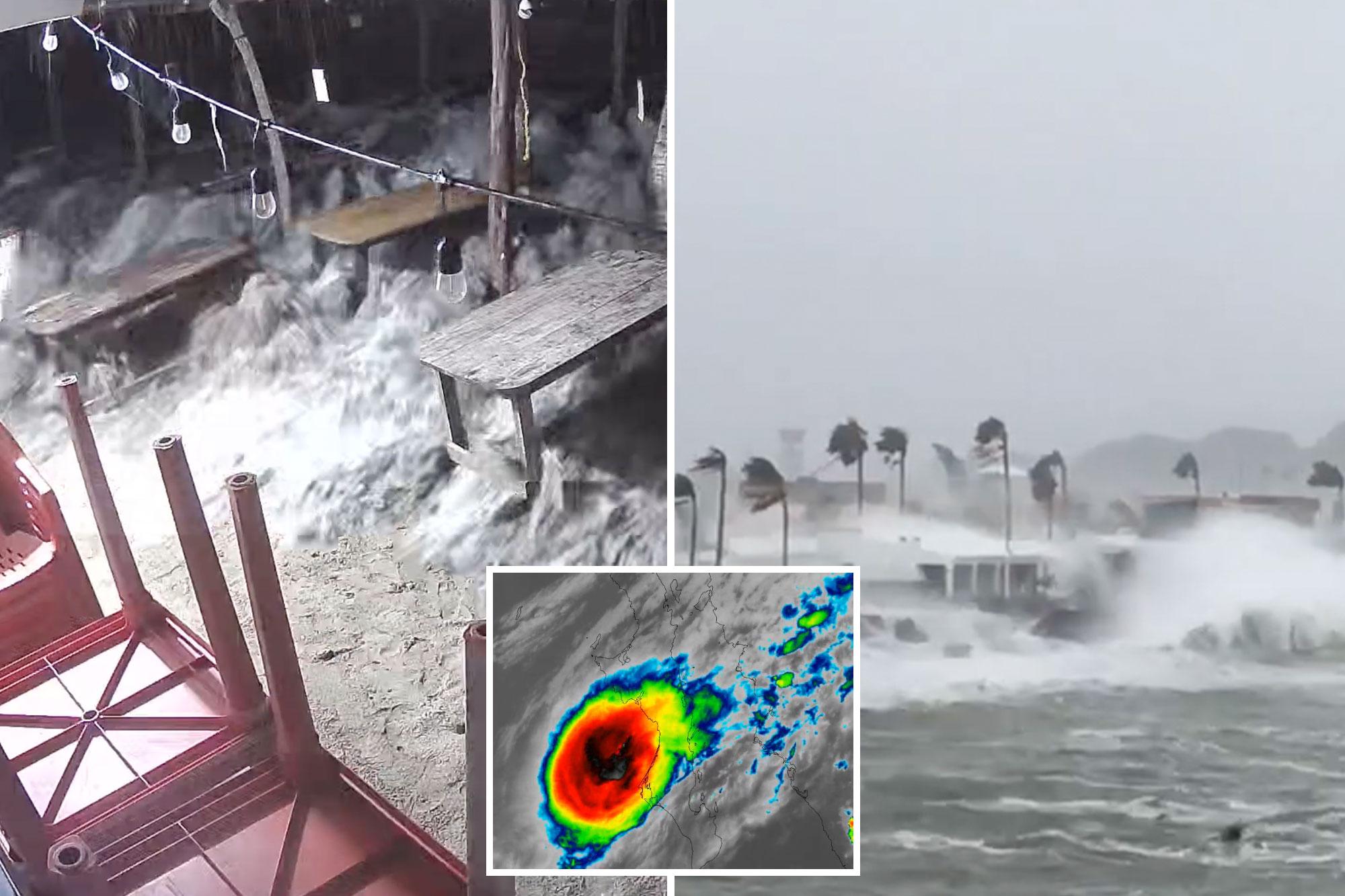
Make California Post a Preferred Source Hurricane Polo unleashed torrential rain, destructive waves and violent winds along Mexico’s Pacific coast Tuesday, with dramatic footage showing flooded streets and battered properties.
The tempest made its first landfall around 11 p.m. Monday local time along the west coast of Baja California Sur, just south of the small town of Las Barrancas, according to the National Hurricane Center.
The storm was likely a Category 2 hurricane at landfall, with maximum sustained winds estimated at 90 to 95 knots, or roughly 105 to 110 mph.
At 5 a.m. MST, the storm had maximum sustained winds of 75 mph, with higher gusts, and was located about 65 miles north-northwest of Loreto, according to the NHC.
Hurricane-force winds extended as far as 30 miles from the center, while tropical-storm-force winds reached up to 90 miles.
Dramatic footage shared by ABC Eyewitness News showed massive waves surging into a hotel restaurant in Playa Azul, as Polo battered Mexico’s Pacific coastline.
Other videos showed powerful surf pounding coastal areas and floodwaters rushing through streets, with vehicles appearing to be pushed or moved by the force of the water.
The NHC warned Polo’s heavy rainfall could trigger life-threatening flooding and mudslides, particularly across mountainous terrain.
The storm was forecast to dump 6 to 12 inches of rain across portions of Baja California Sur, with another 4 to 6 inches — and isolated totals of up to 8 inches — expected across southern and central Sonora.
Polo was moving northeast at about 10 mph early Tuesday and was expected to accelerate significantly as it crossed the Gulf of California.
The hurricane was then expected to make a second landfall over southern Sonora late Tuesday morning, with hurricane conditions expected across portions of mainland Mexico.
The NHC said Polo could still be a hurricane when it reaches Sonora, although rapid weakening is expected once it moves inland over the rugged terrain of northwestern Mexico.
A hurricane warning was in effect for portions of Baja California Sur and mainland Mexico, including the area from Bahia Kino to Huatabampito.
The storm was also expected to unleash dangerous storm surge and large, destructive waves along vulnerable coastlines.
Even after Polo dissipates, its remnants could continue causing problems farther north.
The NHC said moisture from the storm could contribute to heavy rainfall, flash flooding and gusty winds across the southwestern US and southern Plains, including southern New Mexico and far western Texas.
Forecasters expect Polo to weaken into a post-tropical system by Wednesday and dissipate later that day.
The NHC warned that dangerous surf and rip currents would continue along portions of northwestern Mexico and Baja California for at least another day.
California Post News: Facebook, Instagram, TikTok, X, YouTube, WhatsApp, LinkedInCalifornia Post Sports Facebook, Instagram, TikTok, YouTube, XCalifornia Post Opinion California Post Newsletters: Sign up here!California Post App: Download here!Home delivery: Sign up here!Page Six Hollywood: Sign up here!