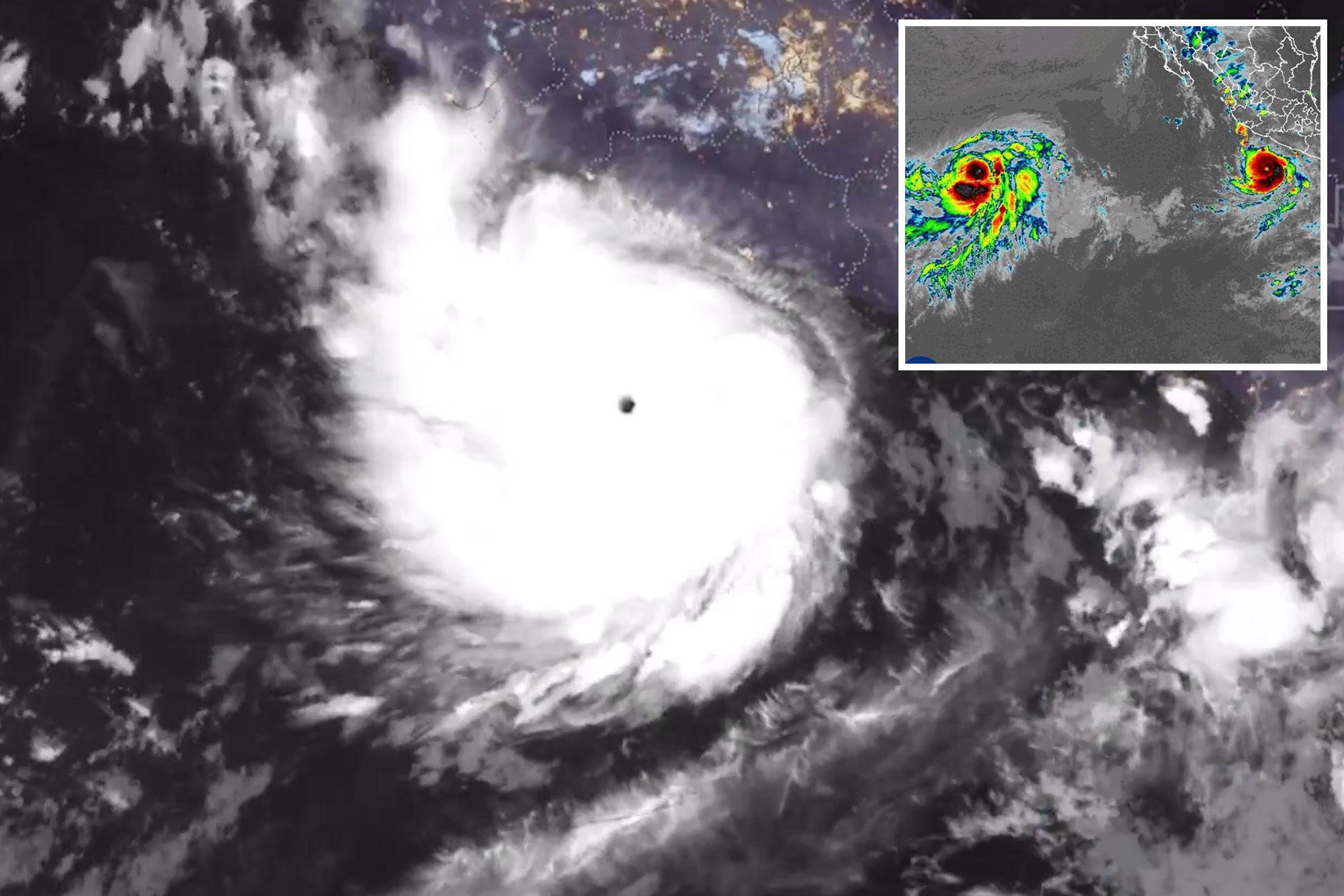
Add The California Post on Google Hurricane Polo has exploded into a monstrous Category 5 storm with 180-mph winds, becoming the second-strongest hurricane ever recorded in the eastern Pacific as it threatens Mexico’s southwestern coast with life-threatening floods and mudslides.
The National Hurricane Center said Polo was still strengthening after rapidly intensifying on Tuesday. The storm is expected to remain “extremely dangerous” for the next several days as it tracks northwestward over an ocean environment loaded with extremely warm water, abundant moisture and low wind shear.
“Therefore even more strengthening is possible,” the hurricane center warned, raising the prospect of an even more powerful storm as Polo continues feeding on the overheated Pacific.
Atmospheric scientist Matthew Cappucci offered a jaw-dropping description of the hurricane’s explosive development when he wrote, “INCREDIBLE developments with Superhurricane Polo, which likely now has winds in the 175+ mph range. It has heated the air enough to lift HALF A TRILLION pounds of air out the middle, driving an incredible vacuum effect that’s resulting in obscene winds.”
Mexico is facing the most immediate threat, with Polo expected to drench southwestern coastal areas through Thursday even though the hurricane itself is forecast to remain offshore.
Forecasters have warned that the rainfall could produce life-threatening flooding and mudslides, particularly in steep terrain, while tropical storm warnings have been issued for portions of southwestern Mexico.
Southern California is expected to escape the worst of Polo, although the massive storm could still stir up trouble along a coastline that has already endured repeated pounding from Pacific weather.
Polo could pull tropical moisture toward the region depending on conditions in the upper atmosphere, according to Bryan Lewis, a National Weather Service meteorologist in Oxnard. However, Lewis put the chance of rain in Los Angeles County at only 5% on Tuesday afternoon.
The more immediate concern is what happens when large southern swells meet elevated tides, with Lewis warning that high surf and high tides could coincide Tuesday and create the potential for coastal flooding.
The National Weather Service in Los Angeles already forecasted elevated surf and strong rip currents at beaches this weekend and into next week as multiple southerly swells move toward the coast.
“After almost an entire summer of southern swell after southern swell, there could be some issues for those vulnerable coastlines,” Lewis told The Los Angeles Times.
That warning comes after Laguna Beach, Dana Point and Carlsbad declared local emergencies this year amid coastal erosion and sand loss linked to powerful Pacific storms and high surf.
Polo is the 16th named storm of the eastern Pacific season and the third Category 5 hurricane following Genevieve and Lowell, tying 2026 with 1994, 2002 and 2018 for the most Category 5 storms ever recorded in a single eastern Pacific season.California is also preparing for the winter weather ahead, with Gov. Gavin Newsom having declared a statewide emergency as El Nino is predicted to be the strongest in at least a generation and concerns grow over high surf and high-impact storms.