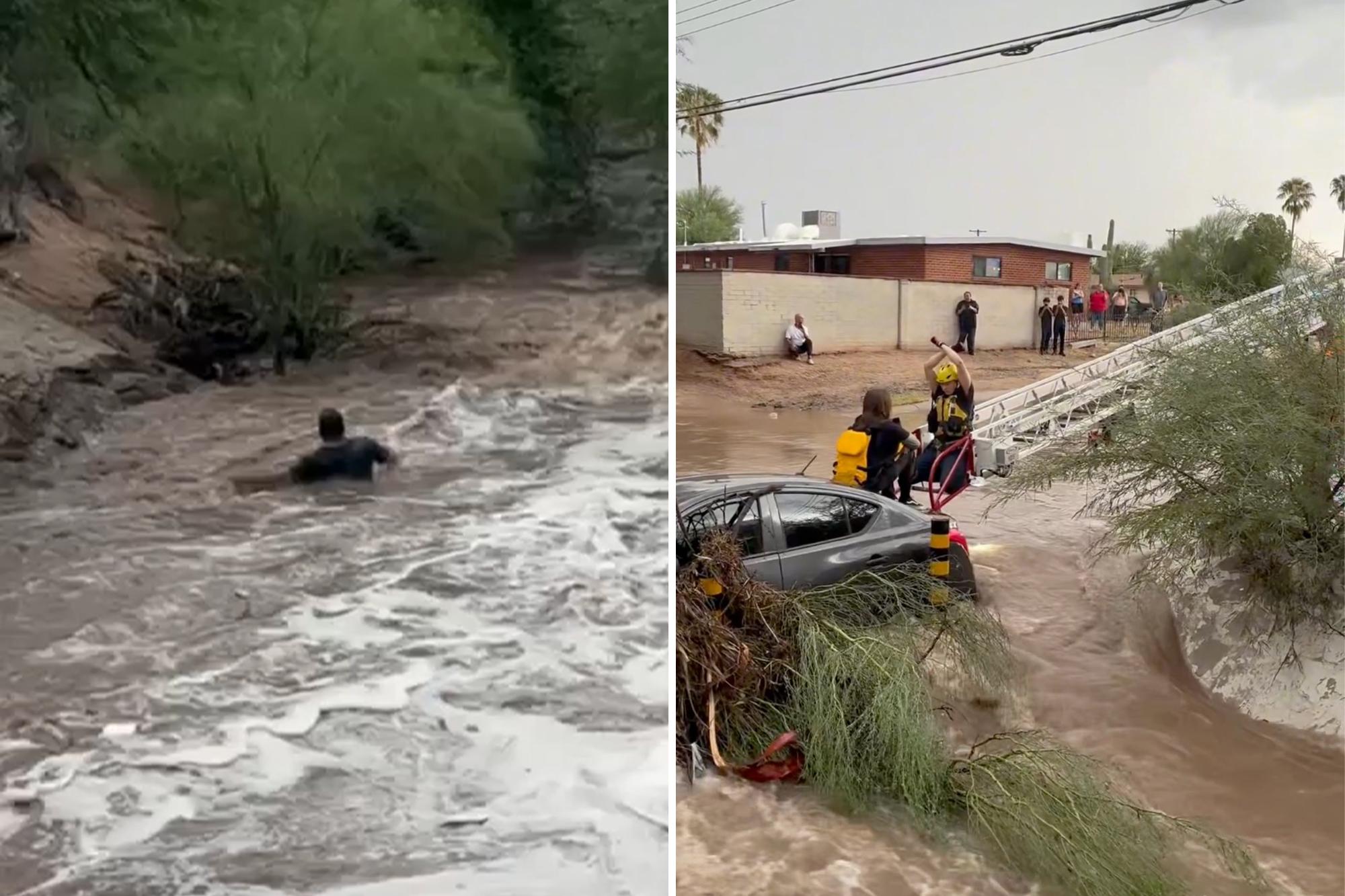
Add The New York Post on Google At least three people were killed as heavy rain impacted communities in the Southwest US while a tropical disturbance enhances monsoon-fueled floods in the region, according to officials.
A very active and potentially dangerous weather day is unfolding across much of Arizona, with significant and potentially life-threatening flash flooding possible.
Water rescues are ongoing in Scottsdale, with several vehicles stranded in about two feet in standing water, according to the fire department. Water rescues are also being reported in the Phoenix area.
All Ruidoso Municipal Schools were closed on Wednesday due to the hazardous conditions across the region.
The residents in New Mexico are also feeling the effects of the nasty weather, as heavy rain has created a serious flood threat for thousands of people.
As a result, there have been three reported drowning deaths amidst the flooding; two adults and one child were found dead at the scene.
As a massive heat dome hovers over the Central and Eastern US, it will act like an atmospheric wall, locking in relentless monsoon weather conditions along its western edge, according to the FOX Forecast Center. The monsoon season usually lasts until the end of September.
This setup will bring a surge of tropical moisture over Arizona and New Mexico, triggering widespread thunderstorms and a Level 2 out of 4 flash flood threat through Friday morning.
Additionally, areas that could receive 2 to 3 inches of rain through Wednesday, such as Ruidoso and Phoenix, have been upgraded to a Level 3 out of 4 flood threat.
Airflow around a high-pressure ridge to the east will continuously pump tropical moisture out of the Pacific, while upper-level energy drifting around the western edge of the heat dome will provide steady atmospheric lift.
With this moisture plume locked in and nowhere to go, persistent storms will fire up every afternoon through Friday.
As a result, Flood Watches are in place for much of Arizona, southern Utah and western and southern New Mexico.
The flood threat also bleeds into Utah, including the iconic Zion National Park. These alerts include popular cities such as Phoenix, Tucson, Arizona, and Ruidoso, New Mexico, where the rain will not let up until Friday, with expected totals of around 1 to 2 inches and possibly 2 to 3 inches for some higher-elevation areas.
On top of this, there will be an increased tropical influence due to the area to watch, which is currently in the Gulf of California.
Tropical disturbances in the Gulf of California are relatively uncommon and have a low chance of becoming a named storm or depression, according to the National Hurricane Center.
Start your day with all you need to know Morning Report delivers the latest news, videos, photos and more.
As this moves onshore into Mexico on Wednesday, its moisture will surge northward into the Four Corners region and increase the coverage of widespread showers and storms.
As these storms bring repeated rainfall over the next few days, the overly saturated soil will not be able to absorb much precipitation and flooding will likely follow.
“Storms will produce high hourly rain rates, driving a persistent risk for severe flash flooding, rapid runoff into desert arroyos, mudslides in steep terrain and dangerous debris flows over recent burn scars across both states through the week,” the FOX Forecast Center said.
Monsoon rain can often trigger mudslides, which makes this flood threat even more dangerous and worth monitoring throughout the week, as conditions could change or worsen.